
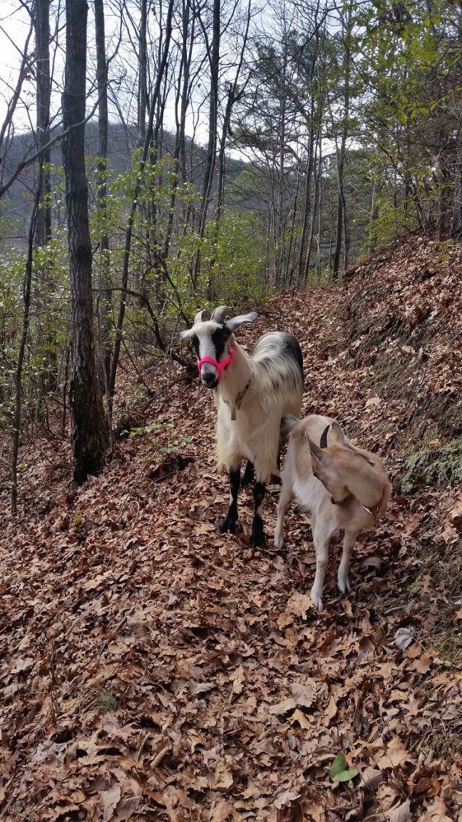
I heard there were waterfalls in Warwoman WMA, but no one knew where they were, (or at least, they weren’t telling). So I did the only logical thing there was to do – pack the goat and the backpack and go find them for myself!
Along the way I found some cool ruins. CCC trout ponds long abandoned. Remnants of the Blue Ridge Railway – a never completed pipe dream that also gave us Stumphouse Tunnel, the original source of Clemson blue cheese and stories about bears popping out of the shrubbery from my mother. Overall, there’s a lot more out there than waterfalls, but I can also confidently claim to have found at least 4 falls: Warwoman Dell Waterfall, Becky Branch Falls, an unnamed small fall, and Martin’s Falls.
Bu-yah useless internet. I can find stuff the hard way if I want to!
Is it goat approved? Dunno. But I wouldn’t bring a goat to Warwoman Dell in the summer…it looks very peopled
How you get there: Google Warwoman Dell – its a nice little picnic area off Warwoman Road just above Clayton, GA. That is the parking location (or you can park on the paved pull off in the turn just before the picnic area on Warwoman Road). There is a brown and white forestry sign just before the turn if you are coming from Clayton.
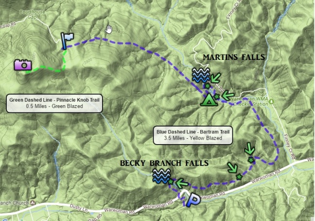
Time for hike: The distance for this hike is 5 miles round trip out and back to Martin’s Creek Falls.
Best season to do this hike: WINTER. The Dell and the area waterfalls see a lot of traffic in the summer months, especially this close to Clayton. I went on a day forecasted for snow and had the place nearly to myself. Then of course it snowed and I had to worry about getting back home…
Trails to Take
Start off in the first pull over once you enter Warwoman Dell. Cross the wooden bridge and take a right at the ridiculously massive picnic shelter. The stone steps will take you up onto the old railroad grade for the Blue Ridge Railroad, which was never completed. Stone ruins remain however, to remind us of John C. Calhoun’s ambitious project that was cut short by an even more ambitious project of his – succeeding from the Union. Had this section of the Blue Ridge been completed it would have joined up with the unfinished Stumphouse Tunnel, a fascinating ruin above Wahalla, SC that was actually used to make Clemson blue cheese at one point.

Past the railroad ruins the trail runs to the upper parking lot and more of those really ritzy picnic shelters. A rock marker for the Bartram Trail (yellow blaze) will crop up just before the picnic shelter, but first, a quick waterfall break. Walk through the fancy shelter and head towards the stream beyond it. At the end of this short trail is a small waterfall, and the trail turns and returns to the upper parking area.

So ends the busiest portion of the hike. To continue on the Bartram Trail go back to the stone marker, then walk down the gravel access road. You will see the yellow blazes start up and then Bartram will peel off to your left. But before you leave the small children swarms behind, walk down to the trail kiosk right past where Bartram heads off. A small side trail at this kiosk takes you out to some nice concrete trout ponds built by the CCC, now long abandoned, but still interesting in their own right.

The Bartram Trail climbs towards Warwoman Road in a series of tight switch backs. At the road it passes a historical marker about, no shock here, Bartram Trail and the naturalist who first made the trek that became the 37 mile trail.

The trail crosses Warwoman and ascends steeply past an old pump house up to Becky Branch Falls. If the yellow blaze Bartram is crowded don’t take the goats up it – this trail is really narrow! Instead, about 50 feet away from the yellow blaze on Warwoman Road is a green blaze – This trail ascends towards Becky Branch Falls but allows you to bypass the falls and get on Bartram without all the drama.
Whichever route you take Bartram heads off away from Clayton along the ridge line paralleling Warwoman Road down below for a while before moving off. It’s quiet, in the sun, and has a nice mix of pine and mountain laurel. It’s almost completely flat too. You’ll cross a gravel road which may in deer season host a check station…with the associated boys in green. If the forestry service is not who you want to meet, plan ahead.
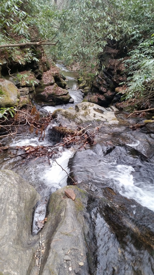
The trail eventually descends down towards a low flow creek, crosses it on a bridge, parallels for a while, then wanders back off into the woods. A gravel road will be visible in winter at this point down hill from the trail. Bartram runs up to a sizable creek and turns left onto what looks like it used to be another trail – an access trail coming up from the aforementioned gravel road. However, fallen trees have blocked easy access from the gravel road and Bartram travels on alone up the creek.

The first waterfall is small, but worth walking down to for the Watkin’s Glen like potholes cut into the rock by the water.
From here it gets better. The trail continues following the creek, which at first stops looking promising at all. The land levels out, and its clear this is a popular location for camping along the placid banks of what you thinking is going to be a thoroughly disappointing stretch of water.
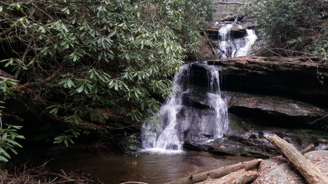
However, after you enter a large clearing with evidence of camping the trail turns, comes up along the creek and ascends to the best waterfall of the hike in my opinon – Martin’s Falls. There is a big wooden boardwalk for this waterfall (it must be popular in warm weather). You have to walk through the boardwalk to continue on Bartram, which heads back to the big clearing, then turns sharply and ascends up the hill headed back towards the creek. It will eventually reach the creek once more, but unfortunately at this point snow-maggedon began and I realized my truck was parked in a thoroughly in appropriate location for frozen precipitation….so I had to head back. In the future I will try to hike the rest of this potentially waterfall rich stretch…

BE WARNED
- Martin’s Falls and Becky Branch Falls have loop trails that allow you to go up to the falls and then take a different route back. This is a sure sign that they are insanely popular in the summer. However, if you find yourself being pursued by some selfie stick toting wannabes who are dying for a picture with a pack goat, remember you have an escape route!
- You’ll cross a gravel road which may in deer season host a check station…with the associated boys in green. If the forestry service is not who you want to meet, plan ahead.

Love this!
LikeLike