
While Croft State Park is more well known for being the sight of Camp Croft, a WWII era military base that left behind a lot of unexploded ordinance, it was also the site of a mineral springs resort called White Stone Lithia Springs (now listed on the Croft State Park map as Whitestone Springs).
Back before modern medicine had really made a dent in the things people died of it was fashionable for those with long term ailments or those who wanted to have a self care weekend to travel to mineral springs resorts and consume or bathe in the water. There were many such mineral springs in the southeast, catering to the southern elite. Various springs had various attractions – hot water, cold water, mineral content, and rather infamously, radium. This particular spring was known for its lithium content, which in the late 1800s was considered something to drink and not something to be mined for car batteries. The primary lithium sources in the water where lithium bicarbonate and lithium sulfate, and tellingly, lithium sulfate is currently used to treat bipolar disorder, depression, and other mental illnesses. So at least for these springs some of the effect wasn’t just placebo. The water was also bottled and sold for those who couldn’t visit the springs in person. The owner J.T. Harris did regular shipments to east coast cities, but also shipped water as far away as Alaska and the Philippines.
The original site which is visited on today’s hike contained a hotel, water bottling facility, and possibly a bowling alley and swimming pool (though I found no evidence of these and the website discussing it did not site sources). The springs were first enjoyed in the 1850s and the owner J.T. Harris built a hotel on the site in 1901, at which point he changed the name of the springs from Kirby Spring to Whitestone. To further increase publicity a picnic was hosted for the South Carolina Press Association at the springs prior to opening to the public (a visit that was repeated once the hotel was up in 1903, 1904, and 1905). The hotel opened for the summer season on July 1st 1901, but by 1904 it was open year around. Before the hotel people stayed in cabins around the site, but the building of the hotel really made the place into a happening spot. The hotel had steam heat, electric light, accommodation for 350 guests and could sit down to dinner 200 of them at a time in an era when Spartanburg county was rural and relatively unpopulated. There was even a trolley that carried patrons from the local train station to the hotel.
Things were going pretty well till March 1906, when a fire in the kitchen burned everything but a few pieces of furniture and the piano. The White Stone Lithia Springs company went into bankruptcy in 1907, but the spring water bottling business continued until at least the 1920s. The first large collection of ruins visited on this hike may be a water bottling facility dating from this time period given the similarities in its layout to the known water bottling ruins at Cascade Springs Nature Preserve in Atlanta, GA. A further fire in the 1930s seems to have been the end of activity on the site.
Today you can visit the fallen chimney stack of the four story hotel that sat on the ridge above the springs dating from the late 1800s, as well as the foundations of the spring house, old road beds, various retaining walls and old bridge supports, and what seems to have been a piping system now corroded away. The best part though is the spring is still there, and still flowing out of the original pipe from the capped well. When the spring was originally opened the water, which is a natural artesian well, shot 30 foot in the air. Today, it’s a bit more modest couple of inches, but it’s still flowing for those who want to try a taste. Which is pretty awesome.

An original bottle from the water bottling plant
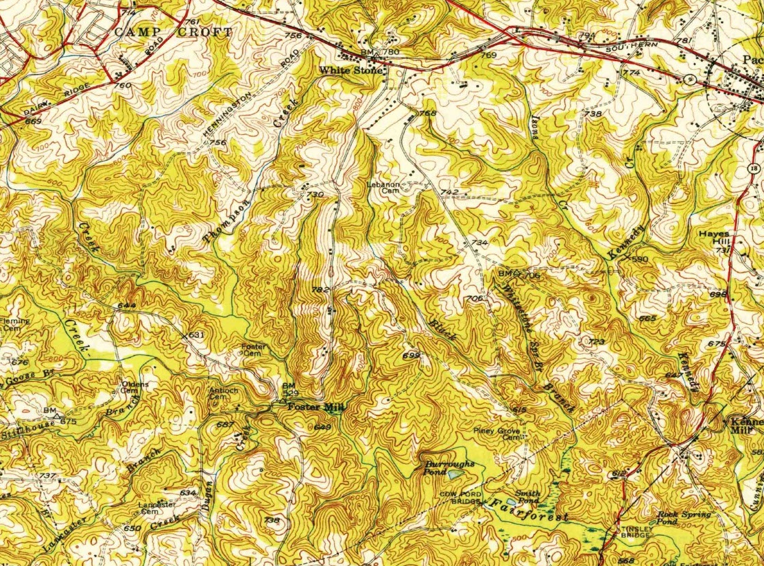
1940s era map of the area, including the town of White Stone
Important: while digging up historical relics in any state or nation forest is illegal, in Croft State Park it can be lethal if you hit buried World War II ordinance. Stay out of the dirt, on the trail, and away from anything metal sticking out of the ground.
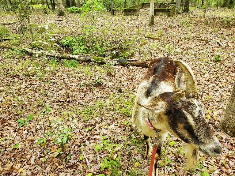
Is it goat approved? While it dates from a few years ago, I do actually have official permission from the park management to hike with a goat here. If you’re respectful of the horses and stay out of the way no one seems to care about the goat on a leash.
How you get there: The best spot to park to visit the ruins is on the “backside” of Croft at 34.881120, -81.836017.
Time for the hike: 8 miles out and back to the spring. You can do more mileage easily, but Croft is known for 3 things: unexploded ordinance, yellow jackets, and mud, mud, mud! This route is no exception to the rule on mud – I personally get tired of it after 8 miles.
Best season to do this hike: Any time, though very dry conditions will lower the mud (but also the spring flow) and summer = yellow jackets.
_________________________________________________________________________________________________________
Trails to Take
Starting off at the parking lot at the very end of the road at Lake Johnson you’ll need to walk towards the picnic shelter to the west of the parking area and look at the tree line. Near where the tree line comes up to the water is a foot path going into the woods. While not shown on all versions of the Croft State Park map, there’s a hiking trail that goes into the woods here. It walks along the lake shore, past wildflowers, over a small bridge, and then becomes a bird nest of interconnecting trails. When in doubt, keep to the trail closest to the lake until you make it around to the open stretch that is part of the lake dam. You’ll cross this open stretch of dam, reenter the woods, and then cross a second open stretch that is part dam, part emergency overflow down to Lake Criag (which you can see a patch of in the distance).
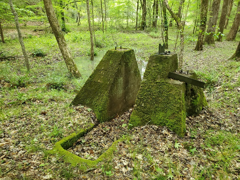
Now the route renters the woods, you want to stay straight on the big, obvious (and generally exceptionally muddy) road bed. Ignore the unofficial trail to your left and the other trail going around the lake to your right. Just stay on the road bed, ignoring Foster Mill which weaves on and off the road bed to your left periodically (unless you just need a break from the mud). Watch for a jumbled stone wall and a large oak tree to your left – this is an old homesite. Just beyond a pair of agave plants marks the site of some more nearly vanished rock pylons that held another structure at some point in the past. Eventually Foster Mill joins the road bed for real and stops winding around as you approach the access road to Lake Johnson. Foster Mill will branch off to the right just before you reach the road, but take a brief detour and keep going down the dirt road bed to the access road for a minute, looking to your left. You’ll see some old concrete stairs piled in the woods, and beyond them is another set of ruins, potentially of a water bottling plant with two spring sources (the two water filled deep well-like holes in the ground).
Once you’re done playing around here and photographing the old concrete foundations, turn back and take Foster Mill. The trail becomes much less muddy (relatively) and walks through some nice woodland that while nice…is also kind of boring. The forest clears as you reach the radio tower, were a picnic table and a rather terrifying horse mounting block and tie post reside. The mounting block is directly under the support cables for the radio tower – horse spooks and rears while you’re mounting and it’s all over. Not a great location.
Moving on from horse assisted suicide, the trail actually continues on the road bed you reach just before you would walk up onto the radio tower’s brick building. It’s not well marked for neophytes to this trail system. You’ll head right on the road bed, re-entering the woods. As you walk look to your left to see a deep old dirt road bed that once accessed this area until the 1970s, but has since been lost to time. Other remnants of times now gone lie among the forest – including another set of forlorn concrete stairs amid a small clearing in the trees. You’ll need to turn onto Rocky Ridge Trail at a fairly obvious intersection that horse back riders hang out at and there is a picnic table. Hang a left to get on the trail and continue out through the woods, with more old road beds visible at various points as you walk. The next turn is left onto Whitestone Spring Trail, which is most clearly marked not by name but by a sign that says “dead end trail”. The trail to the spring heads off beyond it, perpendicular to your trail.
Someone with an incredible amount of time on their hands has lined a long section of this trail with individual rocks, delineating its boundaries. To your left the old road bed descends a washed gully, but to your right, on the crest of a ridge, lies a large pile of fallen masonry stone, the remnants most likely of a chimney from the hotel built near the springs. The trail curves around this ridge, where faint paths suggest a foot trail and access road that once led up to the now vanished building. The trail descends, crossing a creek, and now look to your left and right as you come up along the property line for Croft State Park (placarded as no trespassing and has a bobwire fence). As you pass by the bobwire fence keep an eye out for the remains of a metal barrel, now buried in the swampy ground on the far side of the fence – this may be the remains of a moonshine site (most likely after the spring water business went bust). Various concrete structures suggest a once extant piping system, bridge, retaining walls, and when you reach the spring itself the concrete foundations of a now vanished spring house can be seen across the creek. The trail ends at the creek, and a short hop across the water and up an old stone step to the spring house brings you to the old metal pipe covering the original spring well. Still capped over a hundred years later, the spring water still flows from the tip of the pipe for those unafraid of lead poisoning that want a taste. In fairness, I don’t know the pipe is lead, and lead pipes are perfectly safe after mineral and bacterial growth coats the interior of the pipe, but I don’t trust anything that predates food safety laws. That’s up there with any ruin that comes from the time period they were putting asbestos in everything.
The place is a scenic, relaxing spot to enjoy for a bit before the long slog through the mud back to the car.
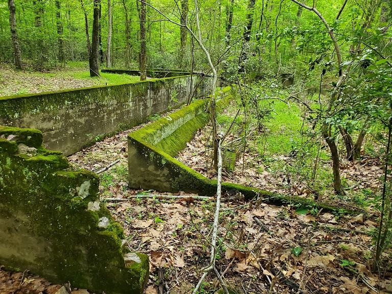
First set of ruins near the roadside – may be the remains of a spring water bottling plant
One of two possible spring well bores (hole in the ground behind Mule) at roadside ruins

Close up of unusual concrete work at 2nd ruin at roadside

Ruins of a chimney at the possible White Stone Springs hotel sight
White Stone Springs resort ruins
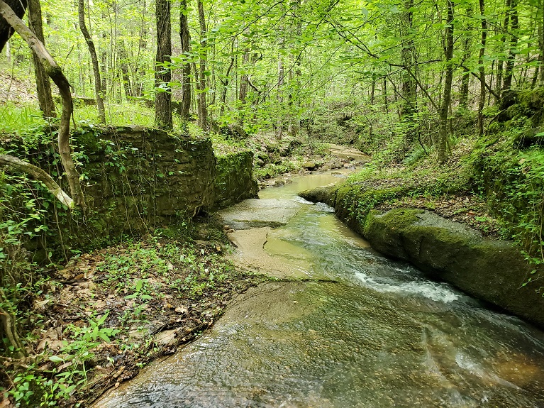
Some of many retaining walls at the White Stone Springs Resort area

Original spring source is the brown pipe on the left hand back ground (still flowing) in this photo for Whitestone Spring

In sum: It is kind of cool that you could treat mental conditions (albeit somewhat haphazardly) by going and drinking a bunch of water from a random spring on the side of a creek.
