
An uninsured deer hit my long suffering truck while a 1000lb round bale was strapped to the back. Therefore, there’s going to be a few more human only hikes until the goat mobile has been resurrected by the miracle working necromancers at the local auto body shop.
On the plus side, it means I get better pictures because I’m bringing the artistic husband along. Particularly on this on this trip, which if you don’t pass out from the never ending stairs, has great views from Table and Governor’s Rock.
Is it goat approved? Nope. Not a good option for goats…way too busy.
How you get there: Google Table Rock Park. It’s off Highway 11 in South Carolina.

Time for hike: The distance for this hike is about 7.2 miles out and back. The going is up the whole way, along a series of soul sucking stone stairs. The last mile or so is across the ridge line, which is down hill-ish to a series of overlooks on top of Table Rock.
Best season to do this hike: Year around, but winter is lower traffic and easier parking.
Trails to Take
You start off at the trail head, which lies behind a nice ranger station…complete with rangers. They like you to register and be off the trail by 4:30pm. Seriously. They fine you if you don’t.


Anyway, the trail starts across the boardwalk. Then it goes up a paved section, across a bridge, and just follow the signs. You start off on Carrick’s Creek Trail, and then smoothly transition to Table Rock Trail. The trail begins to head up hill, crossing and following the creek as it climbs. Then the stairs start.And really they never stop till you get to the top. It just keeps going. The stairs go up and up and up, eventually devolving into rock cut foot holds chipped out of boulders.
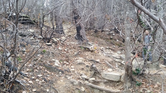
The tops of the mountains here are fire blackened, and the forest is a graveyard of burned out mountain laurel and regrowing scrub. About 2/3rds of the way up the trail there used to be this gorgeous trail shelter with a roof and benches and about thirty years or more worth of pocket knife cut graffiti. Some of the young couples featured probably have kids in college now. Sadly, this romantically scarred shelter is no more, a victim of last summer’s hurricane by the looks of it. The stone platform remains, and is a good overlook. There is a rock face nearby too to stop for a snack if you want.

When the trail finally levels out you are nearing the overlooks. The first is an open rock face, which is NOT Table Rock. This is Governors Rock. They have a sign and everything, but people still think its Table Rock, turn around here, and miss the big Kahuna of an overlook further on.

Keep going, the trail continues down hill, past several more overlooks. The actual end is across another open rock face, then downhill once more to a final massive stone monolith. Beneath you the stone drops away to the lake far below. To the right another towering rock face rises, and to the left, in the distance, a waterfall falls down, and is visible with binoculars. This is Table Rock.

BE WARNED
-
Rangers will fine you for getting off the trail late (4:30pm or later) AND for hiking off the trail. For reals.
-
There isn’t a lot of parking here, and only 2 bathrooms. For a lot of people.
-
It costs $5 a head for adults and $3 per head for kids to get in. Plan accordingly.
-
If you hate stairs you need to pick another trail.
In sum:
Ye though I walk through the valley of the shadow of death, over the crag of doom, wade the river of despair and scramble up a few rock faces of frustration, though art with me, so I know I will make to the overlook. Eventually
