Escape Hunting Season at Danby State Forest

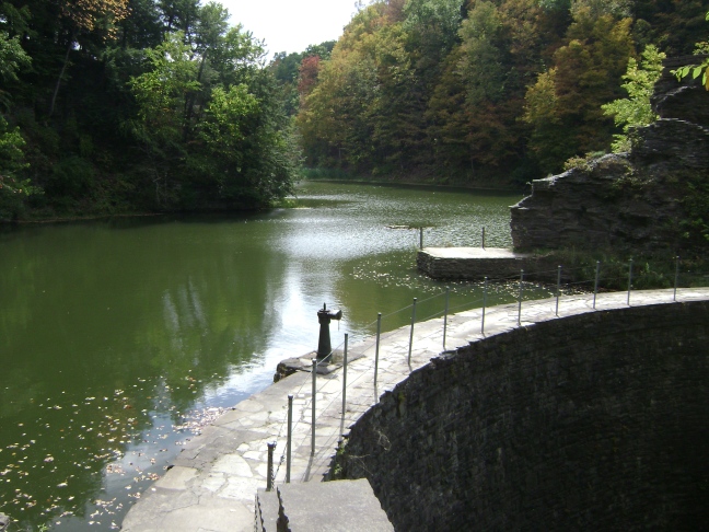
Looking for a place to hike during the dreaded depths of hunting season when the woods are filled with boom of gun fire and the glow of safety orange? Danby State Forest is  a great option. An unusual state forest in that it has virtually no deer or other animal life, (except for the occasional bird or grouse) this hike makes a good option precisely because it has no tasty wildlife within its borders. It also has several house ruins to visit, an overlook, and a well kept up graveyard for those interested in history. So go and enjoy a pleasant day of hiking without having to worry so much about gunshot wounds or getting sniped by arrows!

Location: Danby State Forest, near Ithaca, NY

Is it goat approved? Yep. This park is primarily a haunt of hikers, but given the length of the trails it is possible to take goats, (and even have them off leash), without ruining the experience for your fellow outdoor enthusiasts. Some trails are popular with dog walkers, and I have listed these in the beware section.

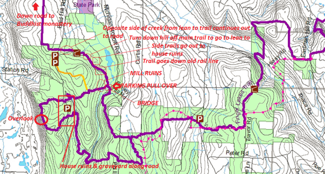
How you get there: You can park one of two places. Either enter the park on Michigan Hollow Road or Bald Hill Road off of Hwy 96B/Danby Road. On Bald Hill Road watch out for guineas/ducks that like to hang out in the road shortly after you turn off 96B. You want Bald Hill Road if your trip must absolutely involve the overlook, and you want Michigan Hollow if your trip must absolutely include the lean-to or the the bridge over the creek. The Michigan Hollow access area is easier with snow on the ground than the Bald Hill route.

Parking wise, if you come in on Bald Hill Road the pavement will end and the gravel will start.  A road will go off to your right to a parking area, but don’t park here. Instead, continue down the hill to where the road makes a very sharp turn, (and becomes Station Road) and a less well kept gravel road goes off straight ahead into the woods. This less well kept gravel road is what you want to go down. Park on the edge of the road where you please, and the trails you want cross this road. There is a small graveyard on your right after you climb a short hill about 1/4 mile from the road juncture. In this vicinity are also some old house ruins to your left. The first trail crossing, (which you take the right hand side of), for the overlook is BEFORE the graveyard in a low lying area. The second is past the graveyard a ways at what looks like a pull off for cars.

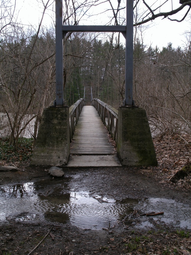
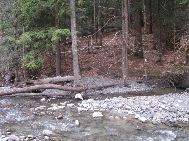
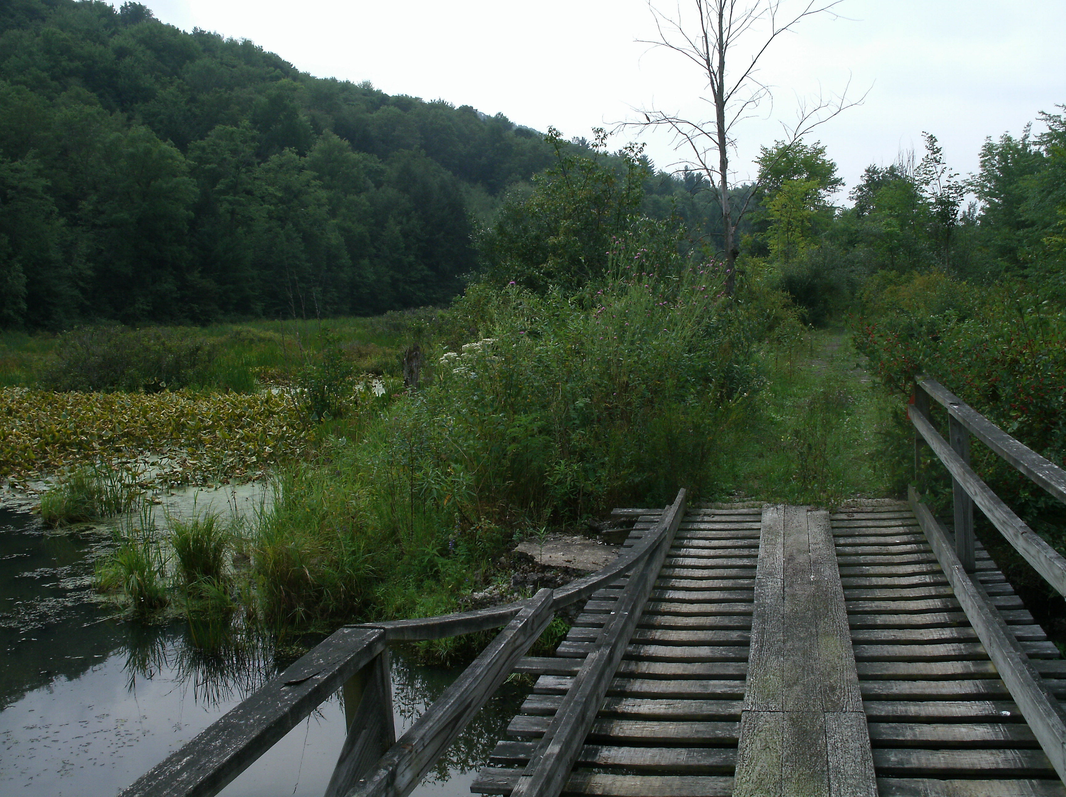
If you come in on Michigan Hollow Road you will pass a dog training facility and the pavement will become gravel. Look for a stand of apple trees and a rough pull off on the RIGHT hand side of the road. Park here, (this parking area is not on the map!). There is a short bridge over the creek, which may be slick for goats in wet/snowy weather. On the other side of the bridge the trail forks. Take the right hand side for the lean-to, house ruins, vernal pools, and flat section of trail that follows an old rail line. Take the left hand to cross the old mill ruins, go to the HOV trail, or head towards the overlook. The lean-to trail is VERY popular with dog walkers and back packers.

Time for hike: The distance is approximately 11 miles round trip as memory serves.This is a loop hike with lots to visit, so plan accordingly.

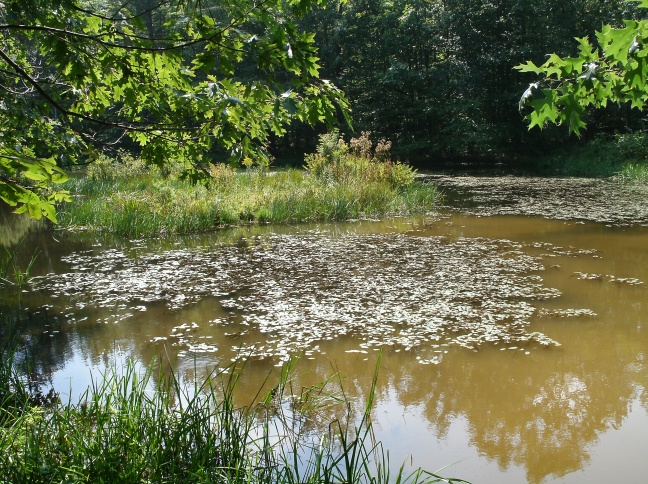
Best season to do this hike: Pretty much any season of the year, but you will meet more people during the summer and the roads ARE NOT PLOWED during the winter around the state forest. Insects can be a problem during the height of the summer in the boggy and low lying areas of the park.

Trails to Take

GE DIGITAL CAMERA
Abbott Loop Trail Sign

First off, this hike is basically Abbot’s Loop with a little bit of extra sight seeing, but you will not see it marked as Abbot’s Loop during most of the trip (but the local day hikers will know what you are talking about if you run into one while lost and say you are trying to complete it). So keep that in mind.

OLYMPUS DIGITAL CAMERA
First snow near the bridge over the creek
GE DIGITAL CAMERA
Creek at Michigan Hollow Rd. parking area with all its summer foliage
GE DIGITAL CAMERA
Apples at Michigan Hollow Rd. parking area (edible but very sour)

I am going to assume you start at the Michigan Hollow Rd. parking area, but you can start at the other spot as well. Given the traffic to the lean-to I would do that stretch first. Start out at the parking area, walk through the apple trees to the bridge over the creek. At the fork, go right. As you proceed along the flat trail that follows the old rail line, look to your right for small foot trails turning off into the woods. When you spot these, follow them if you want to go see some old house foundations. If not, stay on the main trail.

After about a mile or less of walking a white blaze trail (the FLT!) will turn (i.e. double blaze) off the flat trail, up a short rise, and disappear to your right. Follow it. It will wind off into the woods, heading down hill. You will come down into an open area under pine trees, with a creek at the bottom. Cross the creek at the small bridge and go up the hill to the lean-to. Behind the lean-to (used to be blue blazed trail) is the pit toliet should it be needed. Bring your own toilet paper!

GE DIGITAL CAMERA
Maiden Hair Ferns

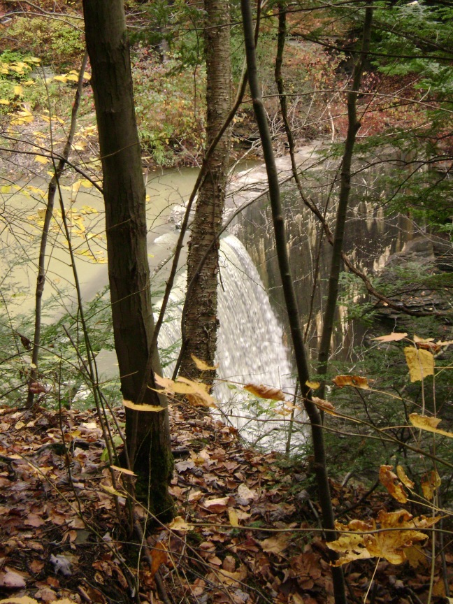
Once you are done exploring at the lean-to you cross back over the creek and either come back the way you came, or go out to the road by following the FLT out of the woods. If you go back the way you came, at the trail fork take the fork you didn’t before and go out through the woods. Just after the fork you will cross stone runs and foundations from a mill that once sat at this site. Then you will climb a hill and come up along side a clearing. This clearing is the end of the OHV trail. If you go into the clearing and look on the opposite side from the trail you entered on you will see a partially grown up trail winding off into the woods. This is easy to follow, and is a short cut out to Bald Hill Road near the intersection with Station Road. It is also a great place to take the goats for off-leash work as few people go this way. I have extended the OHV trail on the Park Service Map attached below to indicate that it does go all the way from the purple trail out to Bald Hill Road.

GE DIGITAL CAMERA
OHV trail sign

If you walk past the clearing you can continue the long way down to Bald Hill Road. Once you reach this gravel road take a minute to walk up the road away from the intersection with Station Road to the well kept graveyard and past the house ruins. Then walk back down to the crossing and continue along the trail. There will be a steep climb now, culminating in a clearing with a picnic table and fire ring at the summit and a nice view of the surrounding countryside, (good place for lunch). Then continue on the loop back down the hill and cross the road. The remainder of the loop is  up and down through the forest, with a nice stretch along a creek bed where I have run into the occasional grouse. The trail will dump you back on Michigan Hollow Road in the vicinity of where you originally parked, and that ends the hike.

GE DIGITAL CAMERA
Overlook 


Danby State Forest Map.png
Trail map. Yellow trail is the OHV trail that runs out to Bald Hill Road

BE WARNED!

  1. The gravel roads around the park are not plowed in winter.
  2. Sometimes cars will drive down the road near the small graveyard, so keep an eye out as you walk this road.
  3. People camp at the overlook and the lean-to at times, which may not be a great situation to walk up on with an off leash goat if they are say eating tasty things for breakfast a goat may want!
  4. The trail out to the lean-to is very popular with backpackers and dog walkers, especially midday. However, there is also a pit toilet at the lean-to for those who don’t think defecating in the great outdoors is an experience they want and some neat house ruins, so visit at your own risk.

In sum: The silence of this forest, with its lack of animal life, will creep even the most hardened hiker out. Therefore this is the perfect hike to take that goat who feels the need to sing, (or well scream), while working like the dwarves off Snow White. Hi-Ho, Hi-Ho anyone?

Headbutting at Buttermilk Falls

If you’ve been watching too much Lord of the Rings or any of its similar fantasy ilk, you may be wondering if fantastic waterfall filled grottoes and timeless winding trails past plunge pools with no discernible bottom actually exist in the real world. If you happen to be in New York (or in fairness, Rivendell) there is a wonderland suitable for elves, pixies, and various other faire folk just down the road. Bring the goat (and the camera) for a fun half day out at one of New York’s less well known gorges.

Location: Edge of Ithaca, NY

Is it goat approved? Sort of, so long as the goat is on leash. Being on the edge of Ithaca weird spectacles (like leashed goats) are not totally outside the realm of the Park Service’s tolerance. But choose a day that is low on people if you are going to try the main gorge – technically the main trail is not a great choice for goats, but I’ve done it twice.

How you get there: Google it! Then, you want to go to the BACK SIDE of the park. Don’t park out front! It’s really hard to deal with all the people. There is a pull off of Comfort Road, just before Yaple Road where you can park. This is also where the Fingerlakes Trail comes into the park.

DSC06698
Car ford typical of roads in Upstate NY state parks

Time for hike:  Something like 4.8 miles round trip. This is an out and back hike.

Best season to do this hike: Fall, after the majority of the leaves have fallen, preferably on a rainy day. Avoid doing this hike in the dead of winter because they close the coolest gorge trail due to ice during the season. For the prettiest scenery, go on a very cold Fall day before the leaves have fallen (but with sufficiently wintry weather to keep the other trail users to a minimum).

Trails to Take

You want to come down from the pull off and get on Lake Treman Trail, going on the side of the lake/river as the pull off you parked on. This will take you around the lake, and up to the dam that forms the lake. Cross over the dam, and then go down the hill to the small parking lot. Cross the parking lot, go down the road a little ways and get on Bear trail, which goes out into the woods on your left. This section of trail is my favorite because it is one of the least travelled sections and still pretty fun because it goes along the river.

DSC06696
Lake Dam

Cross West King Road. If there aren’t many people around and the gate is open, go straight across the road towards the house on the opposite side and get on the Gorge Trail. If there are tons of people, cross the stone bridge and get on the Rim Trail, which is much less popular. If you get on the Rim Trail, turn around before the trail starts a steep dive down hill because this trail dumps you out in a  highly used parking lot near the ranger station. Tourist city! If you are on the Gorge Trail (and thus there are few people) you can go all the way down to the bottom of Buttermilk Falls, and enjoy the full scenic beauty of the park.

Once you’re done oggling, it’s time to turn around and head back!

Buttermilk Falls State Park Map

Be Warned!

  1. The gorge trail closes during the winter because the ice and stuff make it too dangerous for the students who moved to Ithaca from warm climates and urban centers.
  2. The closer you get to the bottom of the park (that is, to NYS Route 13) the more people you will encounter. Go early in the morning on a gloomy day that is cold to limit traffic.
  3. If you really want to do the gorge trail no if/ands/buts park at the athletic fields near the Buttermilk Falls entrance, walk over to the park, and take the gorge trail first, then take Rim Trail back. This allows you to do the gorge trail with the lowest early morning traffic and avoids the risk that you’ll get down to the gorge trail later and it will be packed with people.

In Sum: 

One bucket to rule them all, one bucket to find them. One bucket to bring them all, and in the darkness, bind them.

Poem found inscribed on a much abused goat grain bucket


Social Trails for Goats: Monkey’s Run

Cornell has many trails winding through campus, the gorges, and Ithaca proper, but if you are looking to get out into the woods without actually getting out in the woods, (because you will definitely need to be back in time to get stuff out of the autoclave/mass spectrometer/QPCR/etc. in a few hours), the curiously named “Monkey’s Run” system of semi-social trails is your best destination.

Right on the edge of Cornell’s campus, with an abundance of trail heads and parking to fit even a graduate student or lab technician’s limited free time, this trail is a great way to spend a few hours or a whole day getting out from under the fluorescent lights, off the linoleum floor tiles, and back to nature.


Location: Monkey’s Run Trail System, known by numerous other names, next door to Cornell University.

Is it goat approved? Sort of. There is no rule against goats, and while technically they should be leashed the large number of off leash dogs you will encounter in the area tends to mean that most people you meet will overlook your goat being off leash. I would have the goat leashed when crossing through the community gardens and crop fields, however, as tasty stuff tends to make goats go temporarily deaf.

How you get there: I like to start across the road from the Cornell Plantations, at the gravel pit and suspension bridge, (GPS coordinates 42.454538, -76.455103).  There is a gravel-esque pull off at the trail head you can park on.

Time for hike:  Something like 7 miles round trip according to Google, but there are numerous turn offs and side trails to explore, so expect to spend more like 12 miles to do all the side trails available. This is a loop hike for the most part. 

Best season to do this hike: Fall and Spring are best, (especially during wildflower blooming!). In winter the snow and ice can turn it into a slide and slog suffer-fest and in the summer there’s too many critters of both the bug, dog, and homo sapiens varieties.

DSC07177
The snow can get deep in winter! Unfortunately the terrain isn’t good for crosscountry skiing

Trails to Take

*These are essentially social trails despite the orange and red blazes and the hard work of those that maintain this network. Use my trail maps as a rough guide to where trails are as maps are drawn purely from my memory without the aid of GPS or something that might actually have a prayer of being fairly accurate. *

GE DIGITAL CAMERA
The suspension bridge

Starting at the suspension bridge near the gravel pit, you want to cross the suspension bridge and immediately turn right, (there is a trail that comes off to the right before you cross the bridge that is a nice side trail, but not a main part of the hike).  As you continue along the river look for a trail branching off your left that heads for the hillside, and continue taking any trail that sends you towards the hillside. The trail you want will meander a little bit before heading up hill. As this trail approaches the edge of the woods another trail will come off to your right. This is a loop trail that just goes along the hill top. Take it or ignore it, but it’s really just a side trail. The main trail leaves the woods and runs along the edge of a horse pasture, with a big field to your right.

GE DIGITAL CAMERA
Prayer flags are common on private property around the Monkey’s Run Trails thanks to the local Buddhist monastery, which sells them.

The trail ends into a road. To the left it runs into the horse farm, so you definitely want to go right. The road runs past agricultural fields on the left, and a crosscountry jump field for horses on the right. It will pass through a small copse, then drop you off in the parking lot of one of the apiary buildings, (easily identified by the bee hives in the vicinity). Cross the parking lot and walk over Freese Road.

The trail is marked by orange blazes and skirts the edge of the Cornell Community Gardens, running along the tree line. The river will come up on your right, at the bottom of some very sheer cliffs. The trail continues along the river and is exceptionally easy to distinguish even without the blazes. This cliff edge can be unstable, so let the goats go over and look down if they want but don’t give into the temptation to do the same.

DSC07176
The big rock where it is best to cross the river in winter

The trail wanders in and out of the woods, then descends a very steep set of stairs to the edge of the river. Take a good look at this place! This is where you will cross the river on the way back unless you want to do a little river walking and swimming. The footing in this part of the river tends to be very good, free of holes, and generally not too deep. However, if the river is obviously flooding you may not be doing the full loop today!

The trail continues for what rapidly begins to feel like FOREVER along the edge of crop fields, woods, and horse pastures. Eventually the trail will come up alongside some park buildings/picnic shelters and cross over a small bridge. At this point start looking for a trail heading very sharply DOWN HILL. As you approach this downhill you will pass a stand of human planted pine. A short cut trail cuts through these trees that you can take if you don’t want to do the big downhill and walk around the hole curve of the river.

If you do want to walk down the river, find the downhill, take it, and continue along the river. You will pass the remains of an old road and bridge. After following the river the trail will strike out up hill, bringing you up to what feels like an abandoned dead end road. As you walk along the old road way look for a trail going off to your right into the woods. You want to take this trail! If you get to the parking lot you’ve gone way too far and should turn around and head back.

DSC06604
Near the trail head off Hanshaw Road is a historical school house in an unusual shape

This trail continues to meander along the river, eventually coming up to a powerline cut near Hwy 13. The river is pretty deep here, so if they haven’t built that fancy pedestrian bridge they keep talking about yet, jump the guard rail and cross on the highway bridge. For goats that have not been on main roads this will freak them out, especially if an 18 wheeler happens to come by while you are crossing. If you brought a 2nd human and more than one goat, walk each goat across one at a time.

On the other side of the river do a short hop through the woods back into the powerline cut and keep your eyes peeled for an orange blaze marking the trail. Alternatively, continue up the powerline cut until it reaches a large and obvious utility right of way that is also a well used greenway that you can take back in the right direction too.

If you take the trail instead of the greenway, you will wander along the river again, passing a trail or two that heads off up the hill, (and connects up with the aforementioned greenway). As you approach the old bridge again the woods will thin out with signs of beaver activity, (and signs of humans trying to STOP beaver activity). This is a beautiful area for wildflowers in the spring. As you reach the old bridge another trail will head off to your left up what appears to be the continuation of the old road bed. This goes up to the parking lot off Monkeys Run Road and to another side trail you might be interested in.

The main route continues along the picturesque river, passing a few side trails that can be taken, including a loop trail that overlooks the Cornell research fields. As you walk, keep an eye out for the place with all the stairs you were at earlier on the opposite side of the bank. There is a large rock on the shoreline that makes a very handy marker. For the less intrepid explorer, when you reach this spot, cross the river and go back the way you came in the morning to return to the car.

For those of a more adventurous, insane, or just mildly stupid demeanor, continue along the trail. Shortly after passing a moderate sized island midstream the trail will turn, pass a pile of old gravel, and dump you out on the gravel road that runs around the Cornell research plots. To continue back to the car, you will need to walk in and along the river, (as indicated by the dashed red lines on the map). This part of the river is prone to holes, so take your time. You will need to zig zag from bank to bank as you go along.

DSC06922
Cornell research plots

The river will lead you up to the steel bridge that Freese Road runs across. You cannot, no matter how much you want to, cross the river on this bridge because it has a grating floor that goats can’t walk on.  You cannot, no matter how much you want to, cross earlier to be on the right side of the river prematurely  because that will have you crossing a bunch of private property. What I have successfully done several times is climb the bank just before the bridge on the Varna side, cross Freese Road, go back down the bank, and then very carefully wade or swim depending on the condition of the river bottom, across to the other side. This area is prone to developing VERY deep holes because of the bridge pylons, so take your time, and above all, take goats that know water.

The opposite bank is a tough climb, but doable if you and the goats are lightly loaded. At the top, continue along the left side of the road a few feet, and turn at the gravel drive next to the house. This leads down to another parking area and entrance to Monkey’s Run. You can take the trail from here back along the river to the suspension bridge and thus, the car.

Monkey's Run Hike 1
Start at the suspension bridge!
Monkey's Run Hike 2
Past the community garden and down the stairs
Monkey's Run Hike 3
Down the big hill, look for the old bridge, follow the river
Monkey's Run Hike 4
Over the highway and back the way you came along the river or otherwise
Monkey's Run Hike 5
Walk the river, swim at the bridge, climb the bank and find the parking lot to get back on the trail


Be Warned!

  1. Hunting occurs in the area during deer season. Deer poisoning has also been periodically used to thin the herd in Cayuga Heights, so if you see something that looks like a deer bait station keep the goats away!
  2. The Cornell research fields are technically off limits to non-researchers, but I hiked them for 3 years without so much as a peep from anyone. However, respect goes a long ways – if you want to hike this area keep your dogs/kids/goats out of the research plots and on the gravel road! Graduate students can get really pissed if you screw up their research plots and delay their dissertation! Of course, if you yourself are a graduate researcher and any of your committee members are plant science guys, remember that politics in academia can be very harsh, especially if your goat eats up an entire USDA’s worth of grant funded alfalfa.
  3. If you walk the river watch out for holes, (that is, big nasty deep drop offs in the river), especially as you near Freese Road. Goats and people occasionally fall in these and have a hard time not drowning. Drop offs may form where there weren’t any before after big storms or snow thaws.
  4. You cannot cross the Freese Road bridge with goats. It is a single lane iron grating bridge! Don’t even try it! If you have a pygmy or something you *might* be able to carry the goat across, if the cars actually wait for you.
  5. Swimming and letting the dogs off leash for a dip is very popular near the gravel pit. Plan you trip to AVOID this area if the weather is nice for a swim.
  6. Large flocks of angry housewife types with dogs and small children may be encountered near the suspension bridge mid-morning in nice weather. Avoid them because they’re unhappy that they have to go jogging with all those dependents to avoid gaining weight and their unhappiness will be vented in your direction.
  7. The Ithaca branch of the ASPCA is off Hanshaw Road, and you will pass the area where they take the dogs up for adoption out for walks. These guys are usually on leash, but keep an eye out.
  8. Technically goats (and dogs) should be leashed on all the trails in the Monkey’s Run system, but Ithaca has a generally relaxed attitude to dogs being off leash, so goats off leash are generally tolerated.
  9. Please note that these trails are basically social trails and the maps provided are from my memory of hiking the area. They are not completely to scale, nor likely to be totally accurate when you visit the trail in person. Expect the unexpected!
  10. Be kind so that others might cut you some slack too. A fair number of very casual young hikers go out to Monkey Run and underestimate just how far you can walk down the river, (or become engrossed in the scenery). It is moderately common for them to accidentally exceed the mileage they really meant to do. If you see a bunch of kids that are half dead walking down Hanshaw or Freese Road consider letting them squeeze in with the goats for a ride back to the trail head they started from.
  11. In theory no bikes are allowed on this set of trails. However, you will occasionally find a mountain biker trying his luck. Be nice. In theory he shouldn’t have to deal with goats either.
  12. The cliffs above the river can be unstable. Dying from stupidity is very embarrassing!
  13. Don’t try crossing the river at flood stage or on ice. Duh. Again, dying from stupidity is very embarrassing.

In Sum: Life shouldn’t be all in the research lab. So turn off the cellphone, put the dust cover on those graduated cylinders, and hang your pipetter up for a quick trip to the woods.


Ruminate on the Meaning of Life at Finger Lakes National Forest

What is the fate of the caprine species? Will they forever remain the prank pulling, truck climbing, grain thieving trouble makers that have made their image synonymous with mischievousness and evil? Or is it possible that some day, a peaceful society of goat kind may emerge, where social questions are not answered through violent clashes of horns and aggressive posturing, but rather through diplomacy around the round bale?

Take a nice day out on Finger Lakes National Forest’s trails to let your goats contemplate a new raison d’etre for their species that’s a little less about making trouble!

 Is it goat approved? Yes, though off leash dogs can be abundant on the hiking only trails and may come in packs on rare occasions. Stick to the horse trails as much as possible.

How you get there:  Start out on Picnic Area Road inside the forest. There is a pull off to park at next to a large fenced in pasture (adjacent to a camping spot used by FLT thru hikers). From this pull off you can see the bottom of the pasture and Potomac Road. This is where you want to park, though if you are arriving late you can also park at Blueberry Patch Campground.

Time for hike:  Approximately 6.3 miles. This is a loop hike. 

Best season to do this hike: Any time of the year, though it may be buggy in places during the summer. During the early fall expect to meet a lot of mushroom hunters on the trail, and a sea of orange covered hunters in the winter, but for the most part this park is big enough to spread everyone out.

GE DIGITAL CAMERA
The diversity of fungi in the park is amazing

Trails to Take

Start off by crossing the road from the parking area and going north on Interloken Trail. This is the main trail that many people take through the forest. Interloken will go along for a ways, pass a small pond on your right, and have you walking on boardwalks occasionally.

GE DIGITAL CAMERA
Small Pond

Eventually you’ll reach Foster Pond. During the winter there is a high concentration of hunters targeting the brush behind the dam, so be careful. The pond itself has a camping area on the far side, and is stocked with hatchery raised trout. During very hot weather trout dying from heat stroke may be seen swimming aimlessly at the surface of the pond, (note: these do not taste very good if you try to eat them!).

GE DIGITAL CAMERA
Where Interloken Trail meets Foster Pond
GE DIGITAL CAMERA
One of the trout

Cross the pond dam, and the small creek. The trail will then split left and right. Go left, and you’ll be headed down a horse trail with blackberries and other briers on either side. This area is good goat browse without cows!

This trail dead ends into Backbone Trail. Go right, and continue down a wider trail that runs between pastures. This is another area where hunters are common, but also has a number of semi-wild apple trees, (the remnants of prior domestic orchards, back when apples were a major cash crop in the region). These apples are edible when in season!

When you reach the road, look for the gate to the right. Go through the gate, (and shut it behind you!), and quickly cross the pasture without letting the goats graze since this is a cow pasture. Crossing quickly is also advisable because random groups sometimes show up in this area. I ran into a Bible study group one afternoon that wouldn’t shut up about my goats, (they were reading a Bible passage that mentioned goats or something).

GE DIGITAL CAMERA
Shut the gates!

Anyway, once you’re through the gate on the opposite side of the pasture, continue down the horse trail. Wall ruins are present in this area, as well as at least one geocache. You will reach a pine plantation on your right and Interloken Trail will come in on your right. Go right onto Interloken Trail.

This stretch of woods is great if you want to trail run, with a nice twisty trail, a bridge or two, and soft ground. Eventually the trail will drop you back at Foster’s Pond, and you can take Interloken back out to the car.

There are many great hikes at this park. If you are looking for a longer hike, I highly recommend Ravine Trail for the mushrooms, elevation change, and water as well as Burnt Hill Trail for cow watching and if there’s a cool storm blowing in you want to check out.

GE DIGITAL CAMERA
Backbone Horse Camp, off Backbone Trail, has restrooms and tie ups intended for horses but also useful for goats

Fingerlakes National Forest map

BE WARNED!

  1. Adult dairy cows and beef cows are often present in the many fenced in pastures throughout the forest. If you want to avoid them take the horse and hiking trails in the south of the park, though the cows generally don’t approach the goats. However,  cows can have Johnes. I am not saying these cows do, (and it is likely they only allow Johnes negative herds onto the forest), but that is a possibility. Therefore, it’s not really advisable to allow young goats less than a year of age to go in the cow pastures, as this age group is susceptible to getting Johnes, (older goats to my understanding are not). Johnes can survive up to a year in the soil, so even if cows are not currently present, treat the pastures with caution. On the flip side, the cows managed on these pastures are older, and thus while my herd is and always has been Johnes negative, goats passing through the pastures should not be a threat to the cows (to my understanding).
  2. The ice on the ponds in this area rarely achieves the necessary thickness to avoid a deadly plunge. If your goats, (or your kids, your hiking buddies, etc.), are not clear on ice safety, take precautions.
  3. Hunting is extremely popular at this forest. Delay hiking until noon during the most intensive parts of the hunting season, wear orange, and always stay on trail. Hunters are not supposed to shoot across trails, but reality is not generally the same as the rules.
  4. Occasionally you will run into really strange large camp outs of people in the middle of the woods. These are best avoided since I’m not really sure what they are doing, (when they aren’t FLT thru hikers), but it’s probably something New Age and terrifying. If you don’t want the goat sacrificed, take another trail.
  5. In the winter you may meet cross country skiers. For those new to this sport, cross country skiers like to ski down the tracks laid out by prior skiers, (this is less effort). So if you have a goat, which is a naturally “lets go the easy way” kind of critter, where do you think they are going to walk? Right down the ski marks, ruining them all the way. Is there a rule saying you can’t let the goat do this? No. Is there kind of like common courtesy moral imperative? Maybe, but like most morals, its really up to you to decide what you’re okay with.
  6. The Potomac Trails are really confusing. Expect to get lost.
  7. Always close the gates behind you to keep the cows in.


In sum: It is likely that mankind will achieve universal peace before goats even learn to share the feed trough with one another.

Climb Nature’s Sand Castles at Chimney Bluffs State Park

Do you like going to the ocean but you live in Upstate New York, more than 4 hours away from what is frankly not an appealing coastline when you compare it to Florida anyway? Now that you’ve spend months dreaming about white sands, crashing waves, and the sounds of shore birds are you about ready to quit your job in snow country and move to Miami to make mai tais in a tiki hut? Then there’s one last thing to try before you join the rest of the snow birds down south.

Turns out that while its not exactly the same, there’s a cool park centered entirely around that sand you’ve been craving on the much closer Great Lakes! Get out with a goat and enjoy some serious elevation and scenery at Chimney Bluffs State Park.

Location: Chimney Bluffs State Park in Upstate New York, right on the edge of Lake Ontario.

Is it goat approved? If the goat’s on leash it seems to be tolerated. When it’s not too crowded goats work fine, but when there are lots of people you won’t be able to go out right to the edge of the bluffs or you’ll end up trapped there by gawking visitors who won’t give you enough space to escape! However, walking on the shore works fine.

How you get there: Google it. Frankly, this is an easy park to get to, so I leave it up to Google or your GPS to do the heavy lifting here.

Time for hike: Honestly, don’t plan to spend the whole day on this one. Its only 1.25 miles one way on the bluff trail, and then the same distance coming back on the beach. This is a loop hike. To extend the day out if you are into lighthouses, go visit Sodus Point Lighthouse on the other side of Sodus Bay from Chimney Bluffs before heading back home.

DSC06761
Sodus Point Lighthouse

Best season to do this hike: Winter and spring. Fall and summer there seems to be more visitors, though since swimming is not allowed at the park the number of visitors does not get too insane during most of the year. Supposedly during the summer they charge a modest parking fee per car, but since I don’t go in the summer I’ve never confirmed this.

Trails to Take

Start out at the main parking lot and walk down the paved sidewalk to the picnic area. The bluffs trail should lead off to the right somewhere into the woods. The trail walks through the woods, but most of the hike is right at the top of the bluffs. The trail ends by a steep descent to another parking area, and you can slide down the bank to the lake shore and walk the lake shore back.

photo(1)
Dogo climbing the bluffs
DSC06764
The “no swimming” may be due to invasive zebra mussels in the vicinity that have sharp shells, but I do not know for sure
DSC06768
The bluffs can be unstable
DSC06777
One of the many ridges on the bluffs
DSC06780
The water here, like in much of the great lakes, is unexpectedly clear and much shallower than you would expect. This view is from the top of the bluffs.


Be Warned!

  1. Avoid walking out onto the very edge of the Bluffs when other people are around. I have actually be trapped out on the very tip of a bluff for 10 minutes by people who wanted to ask about the goat and would not let me by!
  2. If there are a lot of people, try just sticking to the rock beach instead of the top of the bluffs. The view of the bluffs from the bottom is a pretty close second to the view from the top.
  3. You may have to pay for parking depending on the season you visit.

In sum: Mother Nature’s sand castle makes those perfect towers and turrets of sand you spent hours constructing at the ocean look like child’s play (which, frankly, they were!).

Wake Up and Walk Into Watkins Glen with a Goat

If you know what Watkins Glen is, then you’ve already spotted the issue with this title. If you’ve not been there, Watkins Glen is probably the best and most gorgeous gorge within reasonable driving distance of Ithaca, NY, and is definitely worth a stop if you are in the area.

However, it is, without a doubt, the biggest of the many tourist magnets in the Finger Lakes Region. Fear the legions upon legions of visitors. The towering monstrosity of staircases loaded with camera toting kids and day tripping house wives. This is not a place where goats are particularly welcome, much less there actually being any space on the trails in the gorge for them.

The beauty of Watkins Glen, though, is that everyone goes to the front part of the park where the gorge is deep and has lots of waterfalls. They pretty much never make it to the back of the park, much less to the Finger Lakes Trail that comes into the back of the park. There’s some pretty nice stuff to see on the back side as well, and thanks to the FLT there’s even places to camp.

*It has been a while since I’ve done this hike, so be prepared for the unexpected! CNY Hiking is a great resource for this and other FLT hikes (http://cnyhiking.com)*

Location: Sugar Hill State Forest, then the Finger Lakes Trail, followed by Watkins Glen.

Directions to Trail Head: The “trail head” is actually a parking location to use a rustic trail shelter on the FLT within the Sugar Hill State Forest. On Templar Road where it runs into Van Zandt Hollow Road, (which runs along the southern edge of Sugar Hill State Forest), there is a spot where a rough two track road branches off going up hill. At this location there is a sizeable creek running right next to the road that the two track road coming off Templar Road crosses. This is the place to park! You’ll need to park along the road side. This trail head can drive you insane trying to find it, so leave extra time.

Untitled13

Is it goat approved? Yes, there are no anti-goat rules and the trail itself is out in the country. However, a short section of the FLT does go through private property that is actively hunted for deer in season, and if you go much further into Watkins Glen you’ll probably want the goat on leash just to keep up appearances.

Time for hike: I don’t know the exact mileage, but it’s something like 4.5-5 miles one way down into Watkins Glen (the town) and of course, then it’s 5 miles back to the shelter.

Best time of the year to hike: Hike this one any season but summer. The insects can be very intense in the summer.

Trails to Take

GE DIGITAL CAMERA
Cemetery renewal project

I usually start out by parking my car on Templar Road, crossing the creek, and going up the two track. This passes a neat little graveyard, and then the FLT heads off the roadway to your right, through the woods, and you’ll see the shelter come up off the trail on you right, just before the trail swings to the left to avoid plowing straight into the river/creek ahead. Leave something at the shelter to indicate that you will be there later should any through hikers arrive so they’ll save you a spot out of the rain, (I left my heavy pack with all my gear, but something less stupidly risky might be better). Most FLT guys are pretty chill, so if you don’t leave anything and show up at 6 pm at night they’ll probably still let you bunk somewhere. Though, this is a great opportunity to make the goat carry the gear in for a change.

GE DIGITAL CAMERA
Primitive shelter to sleep in off FLT (its on the river actually)

Go back down to the car, cross Templar Road, and continue along the white blazed FLT trail, (the trail head should be almost directly across from the two track road you just came down). You’ll walk through a short section of Sugar Hill State Forest land, then cross Van Zandt Hollow Road. Continue up the trail on the other side of the road and you are now on private property (remember hunting season!). The trail meanders along a ridge line and the remains of deer may be present here. The trail is not as well marked and pretty easy to loose during this section. Continue to follow the river if in doubt.

GE DIGITAL CAMERA
River crossing
GE DIGITAL CAMERA
This is what the trail head looked like on the opposite side of the river in 2012

Eventually you will go down a steep hill to a river with obvious signs of past flooding and a potential maze of downed wood. This is Townsend Creek. You can look for white blazes, but given all the flooding the trees that were blazed may be gone! You are looking for a white blaze on the opposite side of the bank near some evergreen trees, (if those are still there!). Take your time finding this one!

GE DIGITAL CAMERA
Unused stone pathways on the backside of  Watkins Glen

Once you cross Townsend Creek you are basically inside Watkins Glen State Park. Continue onward and the trail will start crossing sections of obviously dressed and human set stone, including occasional staircases. All show little signs of use. You will pass by Hidden Valley Camp which has bunk houses and other camp structures. It can be a nice place to stop and grab a bite to eat if not otherwise occupied by campers. Odd structures (like temporary fire rings, symbols, and other random artifacts) may be present in the vicinity of the camp.

GE DIGITAL CAMERA
Hidden Valley Camp bunk house

The trail will cross Whites Hollow Road near where the road crosses a pretty stone bridge. There is a historical marker somewhere around this crossing that talks about the history of the Watkins Glen racecourse. Once you cross the road, continue down the edge of the paved access road, which will lead you to a dilapidated parking area. Past the parking area you will enter a picnic area, with the foundation ruins of a bathroom to your right against the hill. A huge picnic shelter will be sitting on the edge of pond.

GE DIGITAL CAMERA
Picnic Shelter

The trail continues around the edge of the pond, goes up some short uphills, and then runs along the edge of the river. Eventually it crosses under a maintained rail line on a metal trestle bridge. Once you pass under the rail line you are in the busy part of Watkin’s Glen. Proceed at your own risk.

DSC07061
One of the dams on the ponds in Watkins Glen
DSC07050
Active rail trestle

The FLT runs all the way through Watkins Glen and down to the actual road that runs through downtown. If you have someone to hold goats you could run into downtown and get some take out, but otherwise I like to turn around at the rail road bridge, save myself 2 miles of travel time, and get back to the campsite early.

Usually I turn around, wander back, set up camp and eat dinner, then hike back out to the car in the morning.


DSC07046
View of parking area for Watkin’s Glen State Park and part of Watkins Glen (the town).

BE WARNED!

  1. The rustic shelters available on the FLT must be shared. If the members of your party do not completely fill the shelter you will be asked to share space with complete strangers. Be prepared with a tent or tarp should you arrive at the rustic shelter and find it occupied or semi-occupied with those unwilling to share a campfire with a goat. There is a horse camping location right after you cross the creek at Van Zandt Hollow Road on your right if needed.
  2. The crossing of Townsend Creek on the FLT is not possible after heavy rain (and it rains ALL THE TIME in the Finger Lakes region).
  3. The FLT crosses through private property that is hunted for deer in season (during deer season the trail is closed).
  4. Goats (and dogs) are not allowed to sleep inside rustic trail shelters on the FLT. Probably because animal funk is even worse than sweaty-ain’t-seen-a-shower-in-3-days hiker funk.
  5. Is your goat a binge eater? In the winter there isn’t much to eat around the trail shelter…so I hate to say it but you might want hay.
  6. This camping area is out away from civilization. Great for solitude, but also great for coyotes and other critters. During my stay we had some really surprised deer that got close up into camp trying to figure out what the goat was. Oh, and a skunk.


In sum: If you ever run into a Boy Scout Troop leader camping out on the FLT, ask him about the time he spent a really long night teaching a weird chick with a goat how to start fires with flint and steel.

Snowmobiling on Hooves at Ridgeway Road Rail Trail

One of the great unsung wonders of upstate New York are its network of maintained snowmobile trails that traverse long distance over public and private lands. Some trails are tens of miles in length, rivaling the best national park hiking trails in the region. During white powder season of course they are the exclusive haunt of those people who bought a snowmobile for the season they couldn’t ride their motorcycle in. But after the snow melts and the weather warms, or even in winters where snow fall is low, these trails are great long distance hikes for the rest of us, (or at least, the “rest of us” that keeps cloven hooved minions about the place).

Location: Section of old rail bed that runs south from Ridgeway Road, crosses White Church Road, and ends at Hands Hill Road. The rail bed has been maintained as a snowmobile trail by local snowmobiling clubs, thus making the total distance much longer than that visible on google maps. Trail runs through swamp land, but essentially follows Willseyville Creek.

Directions to Trail Head: Start at Ridgeway Road in Brooktondale, NY 14817. You’ll get onto this road by turning right off Coddington Road. Just after you turn onto Ridgeway Road, there will be a small drive to your right leading to a clearing, which sometimes has a picnic table. This is a parking area for the Finger Lakes Trail head (FLT) that a nice guy who lives on the road maintains. You will be parking on grass. The fastest and least confusing way to reach the trail is to walk downhill on Ridgeway Road away from the intersection with Coddington for a short distance, and look to your right. You’ll see the ruins of the rail line on your left, and if you look right, you’ll see a gravel rail bed leading off between bushes. That’s the trail head.

Is it goat approved? Yes, there are no anti-goat rules and the trail itself is out in the country. As the traffic on the trail is minimal this is a great place to hike off leash. Most trail users stay on the north end of the trail, which is gravel and incredibly straight. You may meet a bike or two in this section, but after you cross White Church Road there is usually no one about.

Time for hike: This is 4 miles one way, so 8 miles approximately round trip. This hike is an “out and back”.

Trails to Take

See map at the bottom of this section for the basic set up of the trail. This map is not to scale. “P” marks the parking location, and you can see where Ridgeway Road intersects with the trail. Once you are at this intersection, you can proceed down the trail, which is an old gravel rail bed surrounded by red and orange berry bushes at this point. You’ll see the FLT (white blazes) intersect with the rail bed on your right, and then about 1/4 mile onward it will leave the trail on your left and head off towards Shindagin Hollow State Forest. Continue on the rail bed, which will travel alternating through swamp land and forest. Eventually you’ll reach White Church Road, and see stop signs there warning the snowmobilers to look both ways before they plow across the road and get nailed.

Water point for goats

Cross White Church Road and continue on the rail bed. This area is usually pretty good for wild flowers. You will see a trail go off to your left. This is a good water point for goats as it leads down to the actual creek that winds through the swamp. If you aren’t going to rehydrate your self propelling suitcase on hooves, continue down the rail bed. Another trail will come off to your right, but that is a horse trail that just goes up the hillside to the backside of some farm fields and isn’t really that interesting plus it dumps you out on private property.

Wooden bridge
Wooden bridge

You will eventually reach a well maintained wooden bridge that is a replacement for the original railway bridge over a deep channel in the swamp. This is a good location if you like waterfowl to get out the binoculars and look for ducks and sometimes large turtles. Just beyond this bridge the trail turns left and abandons the rail bed, (which is good, because let me tell you, the rail bed disintegrates after that and the swamp gets scary in a hurry). To continue you must cross through a shallow section of swamp.

Usually someone has put some stones or pieces of wood for you to cross on if you are foot traffic, but this is a location to be careful, especially if you aren’t a New York native or accustomed to swamp land. Take your hiking pole, or a stick, and walk out carefully, pushing the stick into the ground in front of you, and with your goats if they are not experienced, behind you. If the stick starts getting sucked in or the depth of the mud becomes obviously deep, you won’t be doing this crossing today. If you continue with deep mud you or the goat(s) are going to get sucked into the mud, and at this location if you are sucked in you won’t be able to get yourself out. Obviously this is essentially a game over because you’ll be stuck potentially up to your waist or more in cold water in the middle of nowhere on a trail that is rarely used in New York. Have your life insurance policy paid up if you plan to try something so stupid.

Swamp and rail line ruins

Most of the time this crossing does not have very deep mud and is fairly easy to cross on foot in warm weather, or you can cross on the ice in winter so long as it is thick enough. Once you’ve crossed the snowmobile trail is still very visible and goes up into the woods. You will pass through a gate which is sometimes closed, and now you are truly on private land. You’ll walk through the woods for a while, pass some deer stands, and eventually walk along the edge of some farm fields till you reach Hand’s Hill Road. This is the turn around point, so do an about face and return the way you came!

Last Call Bar. Because alcohol raises body temperature in the snow by 5 degrees.

You may see snowmobile signs listing the mileage along the trail to “Last Call”. After several years of wondering I finally discovered that “Last Call” is a bar about a 1/2 mile beyond the end of this trail. So if you want to take a stroll down to Ithaca Road and celebrate your feat with a beer before you head back that’s an additional perk of this route.

THIS MAP IS NOT TO SCALE! But it does accurately represent the route more or less.

BE WARNED!

  1. The end of this trail runs through private farm property, and through areas that are actively hunted. Blaze orange is more fashionable than a bullet hole in your forehead.
  2. If the gate in the woods is closed it’s not usually a good idea to walk around it and go on. Rednecks are not just in the South.
  3. Seriously the water crossing is at your own discretion. For thousands of years man has evolved by having members of the species who had poor discretion die, often in amusing, silly, and painful ways.
  4. This is a not trail to do in the summer! Intrepid explorers who have attempted to traverse the trail during the warmer months have been found dead a short distance down the trail drained of blood and covered in black flies.

In sum: We the few and unwilling, have done so much with so little in the way of trails that we can practically hike anything, even if it’s a snowmobile route!

Urban Goat on the Go: Hiking Cornell and Cornell’s Plantations

Is your goat feeling like an outcast relegated to the rural lifestyle when all she really wants is to be a glamorous girl in the city? Well I wouldn’t recommend New York City as particularly goat friendly, (unless you plan to feed the homeless or something), but Cornell University is a pretty cosmopolitan place that can be visited on four hooves. So take a day to teach your goat how to navigate stop lights and sidewalks instead of creek crossings and switch backs!

Location: Cornell University & Cornell Plantations

Is it goat approved? If the goat is on leash and can handle large crowds of people then this walk works. If the goat cannot do leashes and prefers to keep humans at arm’s length stay clear!

How you get there: Park in the Cornell Plantations (google it!). See trail map for further indication of parking locations.

Time for hike: About 5 miles round trip, but you may want to take several side trips, especially in the plantations or if you have not visited Cornell’s awesome gorge infested campus. This is an out and back hike.

Best season to do this hike: Every season but you may like winter (during winter break) and summer (during summer break) the most as this dwindles the number of students on campus.

Trails to Take

DSC07115
Dogo the art critic surveys the sculpture garden

Start off at the parking area indicated at the Cornell Plantations. If that little lot is full, there are other nearby parking locations within the plantations themselves. Walk from the parking area towards a group of buildings (Plant Production Facility) that sit on the Forest Home Road. There will be a group planting of ornamental plants between these buildings and the hillside. Walk into this group of ornamental plants (some of which are toxic to goats!). There is a set of stairs up the hillside. Take it. At the top of the stairs is a sculpture garden which is pretty cool and was originally created in the 1960’s when this area was a cow pasture.

From the sculpture garden walk down Arboretum Road (or on its edge), then climb up the trail on the hill that Arboretum Road runs along the edge of. At the top of this hill is a large metal bell that you, (or small child of your choice), can ring. Walk around on the trail at the top of the hill to view the rest of the garden from a safe, and relatively people free, distance.

GE DIGITAL CAMERA
Herb Garden perimeter

Get back on Arboretum Road, walk up the hill, then at the top of the hill you will see a large field open to your left. This is the hay meadow, and is a great place for lunch and to let the goat graze a bit on your way back. At the bottom of this meadow, Arboretum Road intersects with Caldwell Drive. Cross Arboretum Road and walk through the plantings of small ornamental trees. You will reach the intersection of Forest Home (which enters after just crossing a metal bridge over the river) and Caldwell Dr. Cross over at this intersection and into the gravel parking lot across the road. Walk through the gravel parking lot and look for gravel paths headed into the woods.

GE DIGITAL CAMERA
Cornell Plantations Visitor Center

You are now in the Mundy Wild Flower Garden area. You do not want to go inside the massive deer fence! Goats are not welcome. Instead, take the gravel path that keeps you closest to the wooden park service buildings adjacent to the parking lot. This will lead you around the fence and to a set of stairs that go up the hillside. Go up the stairs. At the top of the stairs, continue down hill, cross the road, and go down the next set of stairs. You are now in the New York State Herb Garden. If you goat is not prone to treating every hike as a walking buffet line, this is a cool garden to stop and check out. However, poisonous plants are often present and it’s a garden right next to the visitors center so browsing might get you banned.

Walk under the archway and behind the building that sits behind the urban garden. This will take you to a small back garden, then to a paved road running along the bottom of a hill. You want to go right on this road and away from the fancy wood and metal building on your left. The fancy building is the visitors center. Which, since you don’t want to meet a lot of visitors, you certainly don’t want to visit yourself. The paved walkway leads around the hill, (keeping the hill between you and the visitors center). Once you are around the hill look for a trail cutting through the woods to the road (Forest Home Drive again). Cross the road, then head right along the edge of a stone wall. When the wall ends, look for the trail/stairs that lead down to the edge of the pond on your left. You want to proceed along the edge of the pond that runs parallel to Forest Home Dr. Don’t cross the bridge and walk on the opposite side! There will be a lot more people.

DSC06826
Architecture Building with Dragon Day decoration

You will come out on a sidewalk. Walk down the sidewalk for a short ways, then look for a paved walkway to go back down towards the pond. There will be a cement bridge over the river down hill from here. If it’s not too crowded, walk out on it, because this bridge actually crosses over a pretty spectacular gorge.

Once you are done ogling, continue in the same direction you were going back up an incline on a paved walkway. This will dump you out at an intersection. The architecture building is across the road, and to your right the road crosses another ornate bridge. Continue in the direction you were heading, and cross this intersection to continue on the sidewalk. Keep walking on the sidewalk until you see a trail head off to your right. Go down this trail.

GE DIGITAL CAMERA
View of the bottom of the gorge at the end of the hike

Following the trail will cause you to eventually pass a really cool suspension bridge. This one is also worth walking out on and admiring the view. If you continue down the trail you will reach a turn off that goes down a long set of stairs into the gorge. At the bottom of this set of stairs is another cool view of the gorge, but if you walk past the barricades and the signage telling you how people die in the gorges all the time there is a cliff face with a lot of sloughed off scree at the base. This is a great location to locate fossils. Check through the scree and look for pieces of slate with imprints of shells, barnacles, and occasionally more exotic critters in them if you have time.

Then turn around and walk back!

Cornell Gardens 1

Cornell Gardens 2

Cornell Gardens 3

Cornell University Hike

BE WARNED!

GE DIGITAL CAMERA
One of the many entertaining gorge safety signs! The fossil area is just past this sign.
  1. People will want to pet the goat. People will want to take pictures of the goat. Most of these people will not understand anything about goat behavior or biology. You know, the same old mantra.
  2. You will need to pick up after the goat, so remember a plastic bag or two.
  3. There are few good places to give the goat a drink, (despite the number of water sources on the route), so bring a water bottle.
  4. I once got trapped in the herb garden, (which is surrounded by a fence), by a large group of people who did not understand the need for personal space for goats. It got very troublesome. Always remember that on one wall of the garden is a set of stairs set in the wall that you and the goat can use to escape if you get trapped by camera toting tourists.

In sum: Goats can be really freaked out by their own reflections. In this urban environment, take the time to find a reflective building and enjoy the antics as the goat tries to figure out how the “other goat” got inside the glass.

Explore Upstate New York’s Industrial Heritage By Goat on The Keuka Outlet Trail

Do you like ruins? Even if you don’t, it’s a pretty good bet that your goat(s) would. Keuka Outlet Trail is a little bit of everything in that department. It runs along a 1800’s canal atop the old canal road. Hiking it you’ll pass factory ruins and dilapidated river locks. All of which are, joy of joys, explorable! Forget tour guides, protective fencing, and no trespassing signs, this place is a gold mine for urban explorers who happen to live in a very non-urban place. So bring your flashlight and your rope because until they get enough money to build those protective fences and no trespassing signs this place is going to be great!

Location: Keuka Outlet Trail running from Penn Yan to Dresden

Is it goat approved? Yes, it is a goat approved. The trail is horse/hiking/biking rated but fairly quiet till you are in Penn Yan proper, so you can generally go off leash most of the way.

How you get there: Google currently has the trail registered, but in terms of the hike you want to start at the Dresden end, at the parking lot off Seneca Street just off Hwy 14. This is the least crowded and easiest unloading spot.

Time for hike: This hike is a beast at 13.2 miles round trip. Get there early and plan to get back to the car at sun down. Make sure you bring a goat who is in good enough shape to do it. This is an out and back hike.

Best season to do this hike: Every season but winter. The trail is not plowed, (and the parking lot may not be either) so you can’t actually do this trail in the snow unless you have a snowmobile or you teach your caprine companion to ski.

Trails to Take

This trail has a lot of cool stuff to see on it, so content has been edited to fit in the allotted time.

Start off at the parking lot in Dresden, which is right before you cross over the railroad tracks on Seneca Street. On your way in on Seneca Street you may notice a seasonal ice cream parlor. The best part of this trail is that when you are done hiking you can buy really good ice cream at that road side stand on your way home. They do a dependable waffle cone for goat consumption as well.

GE DIGITAL CAMERA
The trail is a true “green way” at this point!

Anyway, once you’ve parked and unloaded, the trail head is right there. The first section of trail runs along the river on the old canal road and tends to be grassy. You will pass under Hwy 14. The river edge along here contains old pieces of glass and ceramic that make it fun to beach comb, but anything of obvious historic value is considered property of the Keuka Trail organization.

You will continue along the trail until you reach your first big area of ruins. This place is great! There’s several old warehouses to explore, the first of two major canal locks, and this area also has toilet facilities that are unlocked sometimes. It does, however, also act as a group camping area for various organizations, so watch out for tents or boy scouts who might be too interested in your goats.

Exploring the ruins
Exploring the ruins

Once you’re done exploring, continue on the trail, which will become more gravel and less grass as you proceed. Other ruins and pieces of machinery are littered along the trail as you go along. Keep an eye out for ruins on the other side of the river as well, especially in early winter. Small side trails will also take you out into the woods to further walls, foundations, and other evidence of historical activity. Take a few of these, especially if you aren’t planning to do the whole trail in a single day.

Ridge Road bridge
Ridge Road bridge

You are a third of the way to the end when you cross over Ridge Road, which runs across a bridge over the river. If you continue on you’ll see more and more gravel in the trail, and shortly beyond this bridge is a dog that warrants some caution (see the “Be Warned!” section below). This area can be popular with trout fisherman during the season, who can be excellent sources of information about the trail and weather if your smart phone isn’t getting a signal.

There is a parking area (just a pull off on the side of the road) and a white sign with the trail’s name and rules posted. This is pretty close to the halfway point between Dresden and Penn Yan. You can also look for the old concrete railroad signs which list mileage in miles between the towns as numbers counting up or down depending on the direction you are coming from. Just past the parking area is a large section of old locks and waterfalls along with a nice picnic shelter. This is a good spot for lunch and a definite camera magnet.

The locks are goat toys more or less

Walk some more and you’ll get to the old mill site, which is best marked by the large brick ventilation chimney still standing at the site. See the “Be Warned!” section for more about this site. There is also some buildings across the river that are well worth your time here, and some old machinery and pulleys laying in the brush for those students of archaic factory design. Walk along the river some more and you’ll eventually reach a clearing with some brick buildings off to the left. Immediately after that you will cross Cherry Street and reach the small parking lot through which the trail continues. Once you’re over Cherry Street put the goats on leash because you are now in Penn Yan, and the number of trail users is going to skyrocket.

The mill's brick chimney
The mill’s brick chimney

You’ll cross under a train trestle, then pass a still functioning old mill and walk under a beautiful stone bridge. The trail becomes paved somewhere in here. The trail passes under another road, then crosses on a bridge over the river. You are almost at the end now! Watch for the sign after you cross the river commemorating (for some reason) a boat construction company site. If you want, you can walk all the way to the end of the trail, which continues at the other side of the park and boat ramp and goes through the trees to the baseball diamond on the other side. The baseball diamond is the “official” end of the trail. However, the last little bit through the park isn’t really worth it, though there are restrooms at the park.

Now, turn around and head back!

Boat factory sign
Boat factory sign
Water point markers as well as mileage markers for the no longer extant rail line are common
The trail becomes more gravel over time
Ruins on opposite side of the river
Clearing before Cherry Road
Functioning mill in Penn Yan
Old lock machinery
Old lock machinery

BE WARNED!

  1. There is (or perhaps now was) a dog about half way between Dresden and Penn Yan that runs loose during part of the day. It will attack goats, (and it has attacked mine). So bring a goat that stands up to dogs and don’t bring the dehorned timid hamburger on legs. Do not expect the owner to come to your rescue, (he’s well meaning but slow moving compared to the dog).
  2. The mill site with the large brick ventilation chimney is littered with broken glass that may damage goat hooves.
  3. The mill site has a section of concrete slabs sitting atop support beams. This means that the concrete ground you are walking on that looks solid can give way underneath you if the support beams have eroded. You could like die and stuff. So be careful.
  4. The rules of urban exploration apply: think conservatively, don’t assume any structure or surface is stable, and you are responsible for your own safety.
  5. Be prepared to pick up after your goat and leash it when the trail becomes paved in Penn Yan.
  6. Leave plenty of time in your trail plans for taking pictures. It’s a long trail with so many awesome things to photograph that time can get away from you.

In sum: Time flies when you and the goats are having fun.

Freezing to Death at Sampson State Park

This is both a trail guide and a rather embarrassing story of how I almost killed myself through stupidity. Again.

Location: Sampson State Park, located between Lake Seneca and Seneca Army Depot.

Is it goat approved? Well, it probably would have been had I not chosen to go in the dead of winter. The area is basically one giant sustained slope down to the lake, and as Sampson State Park was once a military base the “trails” are actually the old base roads. So in terms of geography and structure it is very goat friendly and would make a nice relaxing walk most of the time.

How you get there: Getting here is easy. Google the park name for directions. Remember that it’s on the lake side of Seneca Army Depot (which all the locals know), so when you see the big perimeter fence for the Army Depot or spot one of the Depot’s famous white or piebald deer on the road side you are getting close. You want to go in the main gate across the road from Smith Vineyard Road because that’s were the cool stuff is and all the parking.

Seneca Army Depot has a population of white deer. The old wives tale is that it's from all the radioactive material they used to store there, but the truth is just mundane population genetic drift that can occur behind a fence that stops predators.
Seneca Army Depot has a population of white deer. The old wives tale is that it’s from all the radioactive material they used to store there, but the truth is just mundane population genetic shift that can occur behind a fence that stops predators from culling the easily spotted white ones out.

Time for hike: Due to the size of this place, the hike is just a tour of the interesting bits, probably no more than a mile in total. You can extend it by walking down any of the dozens of roads in the area.

Best season to do this hike: Don’t go in the prime tourist season during the summer because the park is a popular boating and camping spot. Also, don’t be an idiot – don’t attempt this place in deep snow! This area is open, always windy, and no roads into or out of the park are plowed. There are few people living in the area surrounding the park and no one appears to visit once the snow sets in.

Trails to Take

There were fewer ruins than I expected for an ex-military base, and almost all reminders of that part of the area’s history have been bulldozed at this point. However, for those who have lived or worked on military bases the layout of the roads will be enough to set the atmosphere and hearken back to the base’s heyday in the 1940s and 1950s.

Base signage
Base signage

To start with, enter the base at the main entrance across from Smith Vineyard Road. You’ll know its the main entrance because it will be a double road way with a median in between. This goes down to a traffic circle, and you want to go around the traffic circle and continue straight ahead in the direction that you were traveling when you approached the circle. You’ll pass parking areas, and then arrive at the museum, (a short square building with a fighter plane mounted outside). You want to park near the museum because it is easiest landmark to find again, as well as being the only windbreak you can park behind.

One of the fighter planes

Spend some time checking out the planes and memorials around the museum. The museum is sometimes open during warmer months, necessitating parking farther away from it to unload goats in peace.

The next thing worth seeing at the park is the boating facility which dates from when the base was in active service. Getting there is simple – walk down towards the lake from the museum and you will literally walk onto it. At this point if the weather is cold the wind is going to hit you and start freezing your face even through a ski mask. If you brought a human companion finish your conversation at the museum because your face will be frozen to the point you cannot speak by the time you reach the docks. The docks are worth spending some time to explore. From there, if you are facing the lake, walk to your right along the shore until you pass through some trees and enter the campground. Do not be fooled – walking into the woods will in no way actually dent the wind that is hitting you. The campground makes a nice loop in less chilly weather, (though of course when the campground is closed only), but in the freezing cold by the time I had reached East Lake Road at the other end of the campground I had lost the use of my hands entirely and the goat had turned into a giant puff ball of fur, blanket, and pack. At which point, of course, there are no more pictures at all from this trip!

Walk to your right down East Lake Road and you’ll be headed back to the area of the museum. Once you reach the museum you can choose to go down any of the other roads or explore the old parking areas between the museum and the entrance, but there really isn’t much worth seeing at this point. If you want a long trek there is a pioneer cemetery in the south of the park, but I have not personally found it.

During my visit, by the time I had returned to the museum not only could I not speak or use my hands, but I was starting to get cold and beginning to have trouble thinking straight. I had on full New York winter gear, (ski mask, snow gloves, glove liners, pack boots, snow pants, regular quick dry pants, winter socks, a serious winter hat, scarf, three shirts, and an ice fishing coat on top). Had Dogo not been leading the way in a thoroughly pissed manner back to the car and had the museum not been a large obvious landmark between the snow covered ground and the white cloud covered sky I might have kind of ended up dead. As it was, I learned the hard way how to use my teeth to hold my keys, (foolishly I had locked the car in this essentially abandoned snowed in park), to unlock the car. I also developed a special bad Chinese martial arts movie stance where in I used one leg to assist my useless hands to open the car door. Figuring this bit out took 15 agonizing minutes were I kept mentally repeating “I refuse to die out here of my own stupidity” to keep myself warm. Oh, and again used my teeth to actually turn the key in the ignition to turn the car on. Luckily the hatch wasn’t too difficult to get open and Dogo helped herself to the back seat, so after we sat in the car and heated up for a bit where I kept letting how stupid I had been sink in, we left and I decided not to tell any of my coworkers what I had decided to do for the weekend. Ever.

Moral of the story: Preparedness is not just about having the right gear for the weather. It also means not knowingly taking a stupid risk. You can dress for any occasion, even your own funeral.

Be Warned!

  1. Again, no roads are plowed in the winter, all facilities are shut down, and no one visits this park during the snow season. Plan better than I did for this.
  2. It is always windy here. Did you look up the wind chill effect before you left? Lower that wind chill effect another 5 degrees and that’s what it will be like when you get to the park.
  3. This park is much bigger than the map makes it appear. Those harmless looking roads in the park? They run for a really really long ways. Check mileage when you plan your route.
  4. Avoid the summer. This is a popular tourist destination.